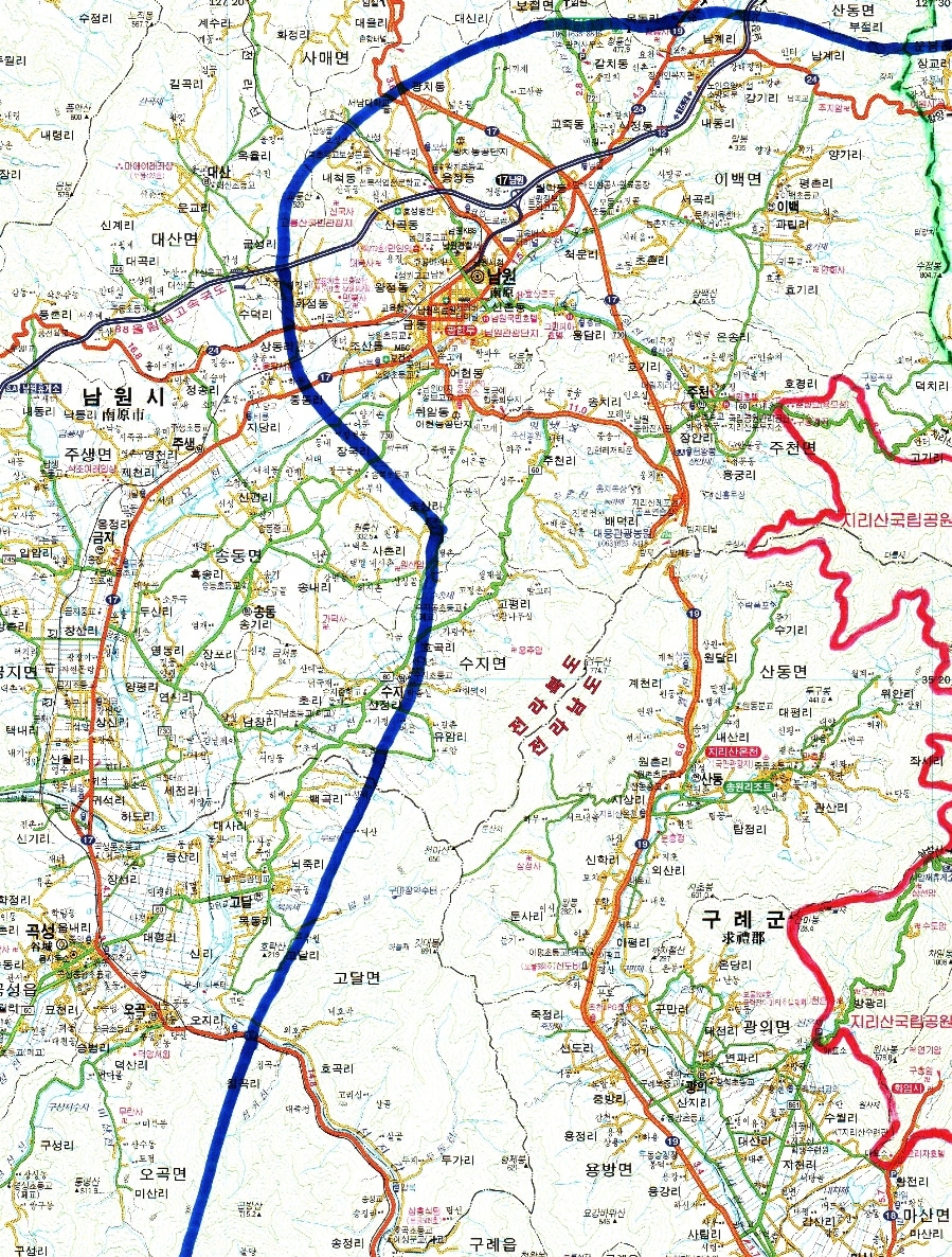
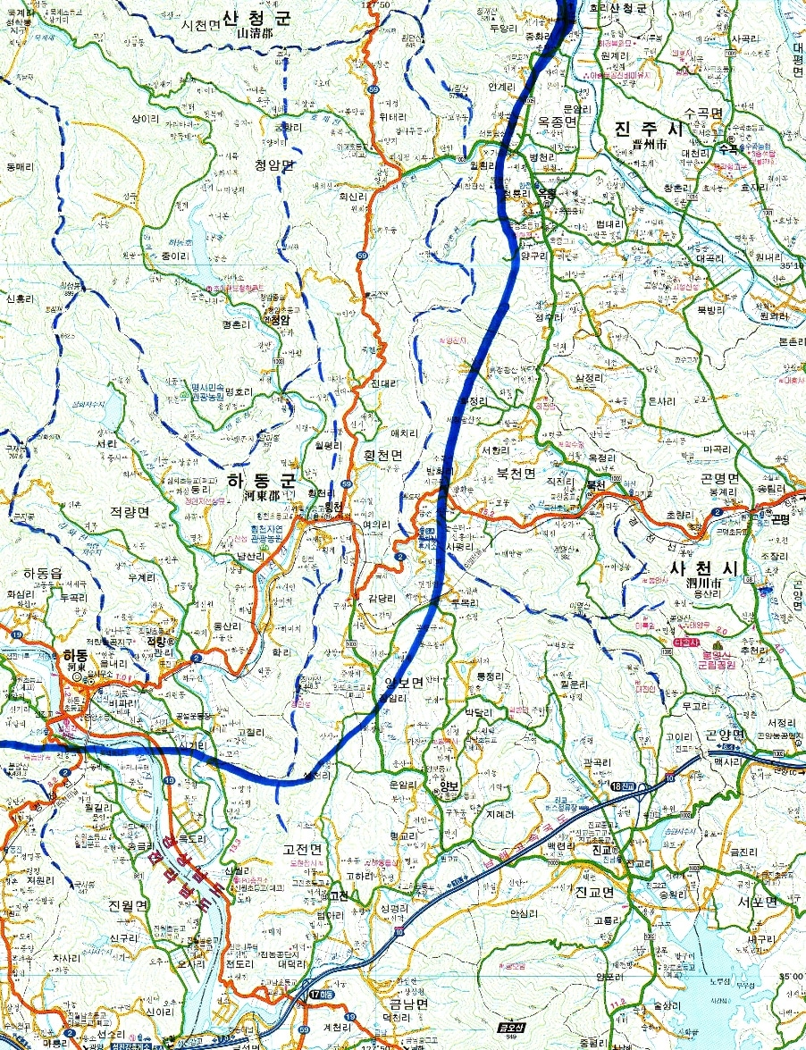
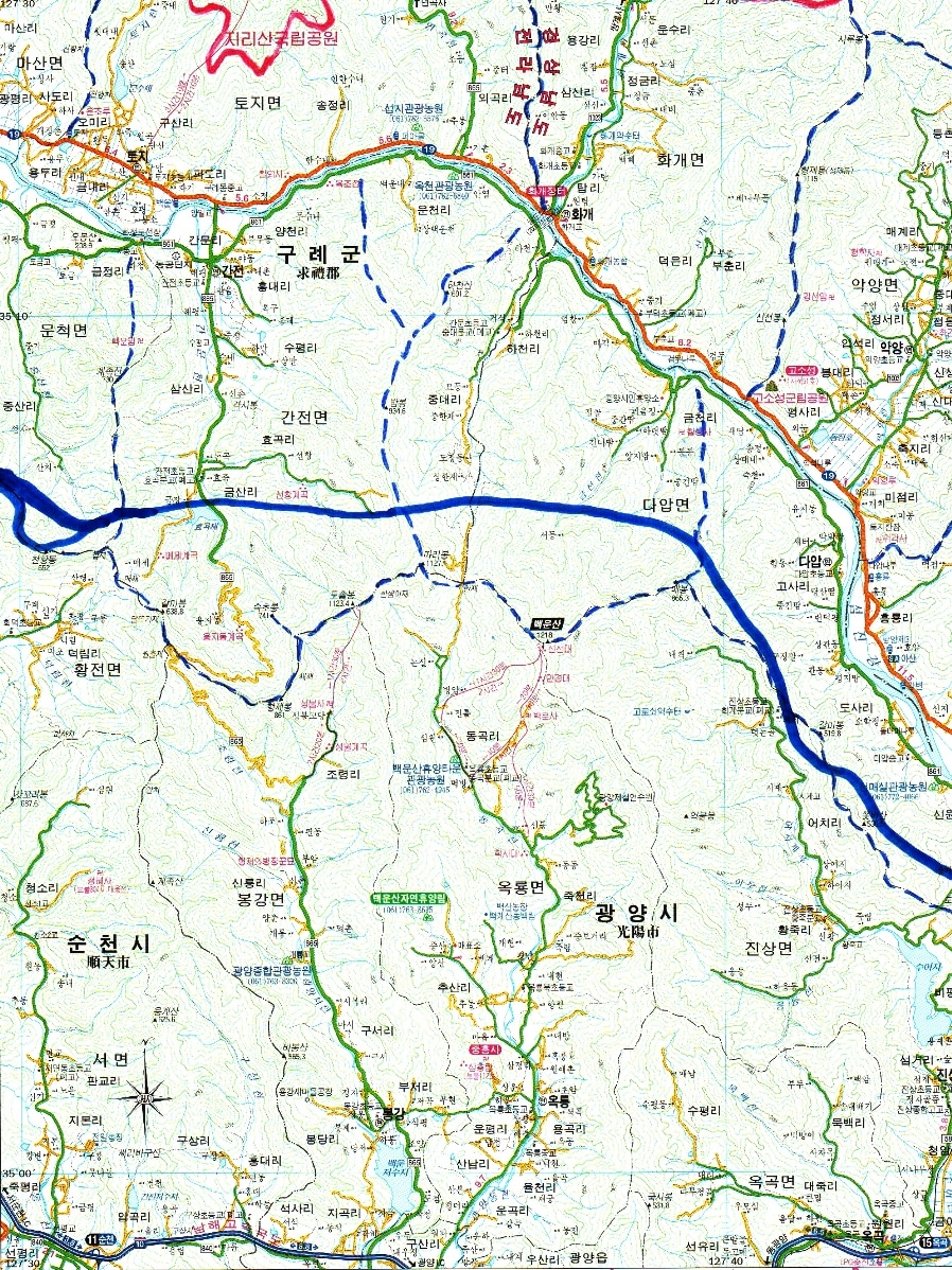
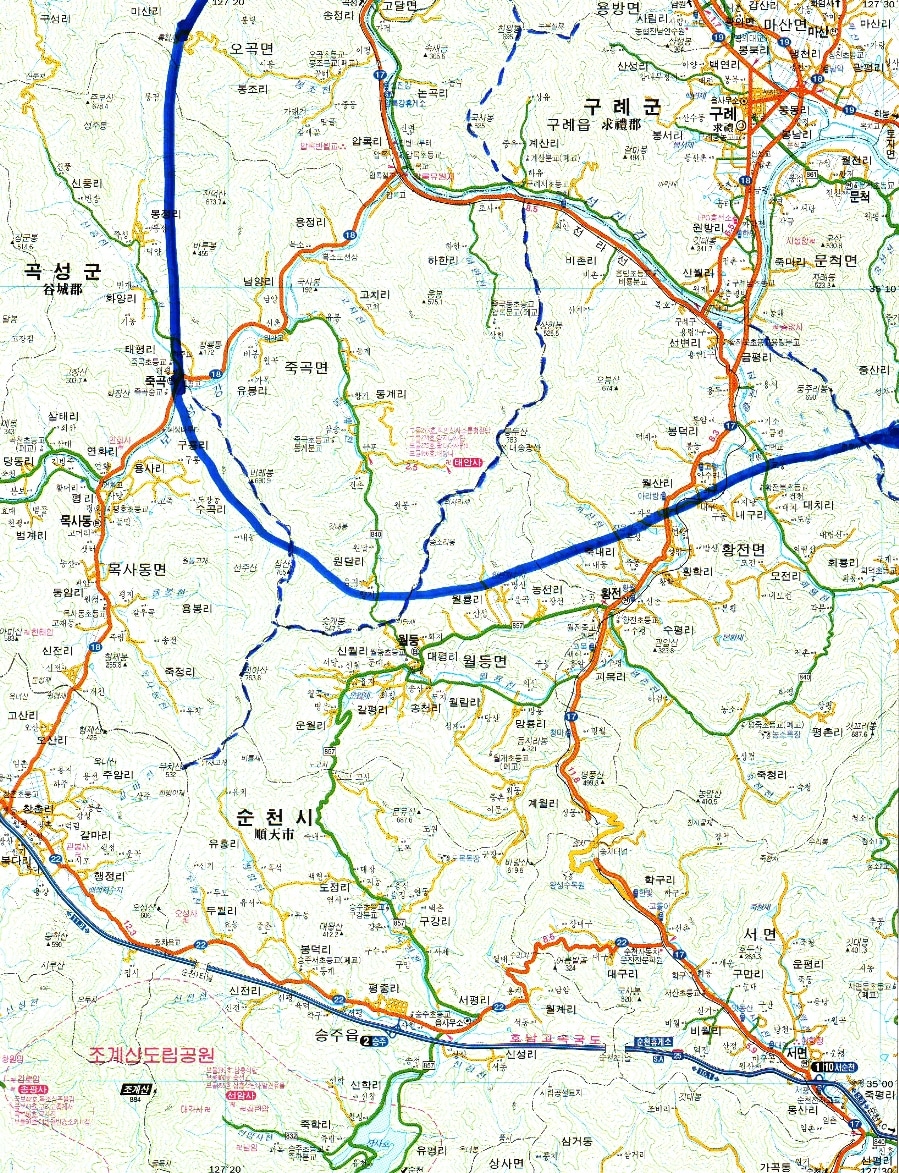
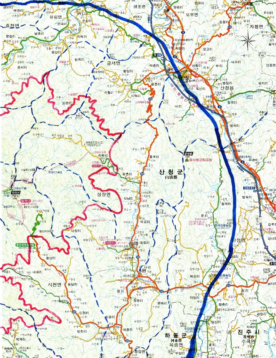
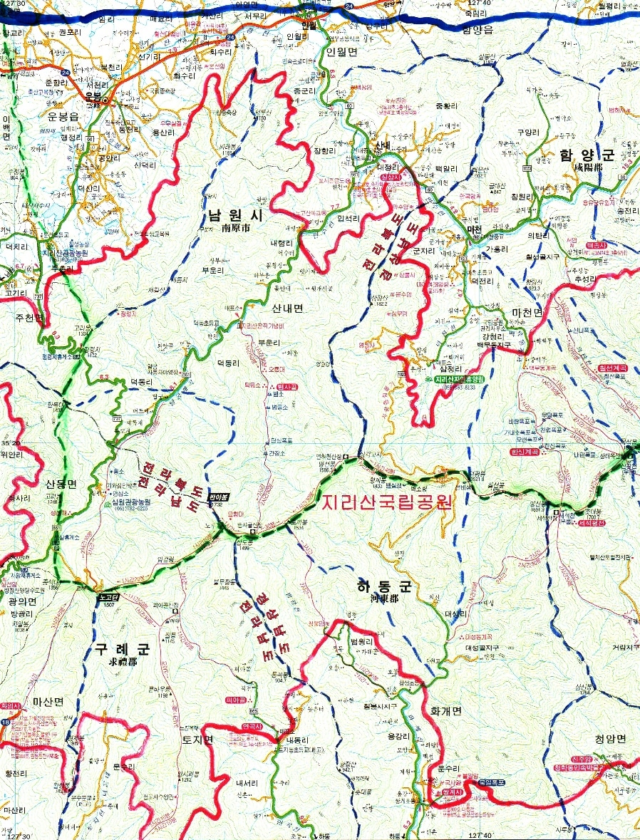
| Map of Jiri-san Area |
| Namwon City |
| Gurye Town |
| Bongmyeong-san Dasol-sa |
| Hadong Town |
| Sancheong Town |
| Sambul-sa Muju-am Samjeong Peak Sang-muju-am |
| Akyang Town & Valley |
| Wangsan Peak |
| Eungseok- bong Peak |
| Jiri Hot Springs |
| Inwol Town |
| Unbong Town |
| Gokseong Town |
| Honam Expressway #25 |
| Expressway #35 and National Highway #3 |
| Sanghan Peak |
| Guksa -bong |
| Cheon- wang Peak |
| Hyeongje Peak |
| Cheonma Peak |
| Gyeondu Peak |
| Manbok- dae Peak |
| Shimwon Village |
| Jungheung-sa |
| South-Coast Expressway #10 |
| Cheongam |
| Byeokso-ryeong Pass & Deokpyeong Peak |
Heavy Red Line: Jiri-san National Park Boundary Thin Red Lines: hiking trails -san = Mountain
Heavy Blue Line: the Greater Jiri-san Region Thin Blue lines: streams -bong = Peak
Dashed Green Line: Main Ridgeline and Baekdu-daegan Line Strong Green Lines: paved roads -sa = Temple
Dashed Blue Lines: other major Jiri-san ridgelines Orange Lines: National Highways -am = Hermitage
Heavy Blue Line: the Greater Jiri-san Region Thin Blue lines: streams -bong = Peak
Dashed Green Line: Main Ridgeline and Baekdu-daegan Line Strong Green Lines: paved roads -sa = Temple
Dashed Blue Lines: other major Jiri-san ridgelines Orange Lines: National Highways -am = Hermitage
| Seomjin -gang River |
| Seomjin -gang River |
| Seomjin River |
| Seomjin River |
| National Hwy 20 |
| National Hwy 20 |
| National Hwy 59 |
| National Hwy 19 |
| National Hwy 19 |
| National Hwy 19 |
| National Hwy 19 |
| National Hwy 24 |
| Hwy 59 |
| Git-dae Peak |
| South-Coast Expressway #10 |
| 88-Olympic Expressway #12 |
| Gori-bongPeak |
| Sujeong- bong Peak |
| Seomjin River |
| Goso-seong Fortress |
| Baekun-sa |
| Hwarim-am |
| Dansok- saji Site |
| Daewonsa Valley |
| Sambong -san Peak |
| Beobhwa |
| Muryang-sa & Guhyeong King's Tomb |
| Baekjang-am |
| Chilseon Valley |
If this is too big, try setting your
browser "zoom" to 75% or 50%...
browser "zoom" to 75% or 50%...
Source of original base-maps: "Jeon-guk-doro gwangwang-sangsedo
1:100,000 Doro-jido" published by Seongji-munhwasa of Seoul in 2003.
Used here by the company's permission.
1:100,000 Doro-jido" published by Seongji-munhwasa of Seoul in 2003.
Used here by the company's permission.
| Anguk-am & Geumdae-am |
| Baekun-am |
| Seojin-am |
| Seoshi- cheon Stream |
| Seoshi- cheon Stream |
| Donggye -cheon Stream |
| Boseong -gang River |
| Yo-cheon Stream |
| Yo-cheon Stream |
| Seomjin -gang River |
| Yo-cheon Stream |
| Godal Town |
| Shimjeok-sa |
| Jigok-sa |
| Hwarim-am? |
| Ganmi Peak |
| Yeonhwa-sa |
| Samjang Town |
| Shicheon Town |
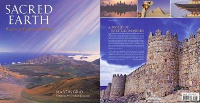
places on Martin Gray's excellent Sacred Sites
of the World website, on this page about Korea.
For plenty of information and beautiful photos
of the world's holy pilgrimage destinations,
get his excellent new 275-page book:
Sacred Earth: Places of Peace and Power.
of the World website, on this page about Korea.
For plenty of information and beautiful photos
of the world's holy pilgrimage destinations,
get his excellent new 275-page book:
Sacred Earth: Places of Peace and Power.